
England's Historic Seascapes: Withernsea to Skegness
Museum of London Archaeology, 2010. https://doi.org/10.5284/1000104. How to cite using this DOI
Data copyright © Historic England unless otherwise stated
This work is licensed under the ADS Terms of Use and Access.


Primary contact
David
Bowsher
Director of Research
Museum of London Archaeology
Mortimer Wheeler House
46 Eagle Wharf Road
London
N1 7ED
UK
Tel: 020 7410 2285
Resource identifiers
- ADS Collection: 935
- ALSF Project Number: 4730
- DOI:https://doi.org/10.5284/1000104
- How to cite using this DOI
Leman Character Area
Present Day Form
The Leman offshore character area is situated in the southern-eastern section of the study area off the north-east coast of Norfolk. The geology of the area comprises a complex of Jurassic and Triassic bedrock overlain by glacial till (clay, sand and gravel debris deposited from ice sheets) known as the Elbow Formation. The water depth across the area varies between 15 m and 30 m and the maximum tidal range is 2-3 m.
Sea Use: Present
The Leman character area dominant character is gas related industry. The field was discovered in 1966 and started production in 1987. With reserves of 174 billion cubic metres and a peak production of 10 billion cubic metres per year it is one of the southern North Sea's major fields with permanent installations both on the seabed and free standing rigs. The field is connected directly to the Bacton Gas Terminal in Norfolk by a pipeline.
The principal fishing activity in the area is part of the Leman Ground fishing area with trawling in the deeps between the mega ripple shoals for white fish such as cod and whiting and flat fish such as sole and plaice. There is also fishing for brown and pink shrimp. The fishing in the character area is limited by the number of sea bed obstructions associated with gas exploitation.
Sea Use: Past
The Leman character area has been shaped by thousands of years of dynamic sea level changes and erosion and deposition. The relatively shallow nature of the sea bed means that the area was dry land almost certainly in the Upper Palaeolithic, Mesolithic. Marine traffic would have historically avoided this area but numerous wrecks will be found here possibly dating from the Roman period onwards.
Fishing activity would have been carried out in the area from the medieval period onwards. The Leman Ground is a named fishing ground on Close's Fisherman's Chart (UKHO 1953), which describes the area as a good fishing ground in between the shoals. In the south, June to Sept are good months. Fish: Plaice Soles Cod and Dabs.
Archaeological Potential
The Leman Ground character area has potential for the presence of drowned land surfaces resulting from the fact that sea level has fluctuated between -120 metres and +10 metres over the past 500,000 years. From the period 500,000 BP to 22,000 BP (before present), human population levels were low, and little more than stray finds may be expected, although these may still be of considerable archaeological importance.
From 22,000 BP to 2100 BP parts of the North Sea were dry land and human population levels were higher, especially in the Mesolithic age. Finds dating to the Mesolithic have been found to a depth of 40m so any area of sea bed above that has potential for habitation. Inundation of the North Sea landscapes occurred between 10,000 and 6,000 BP and the most likely evidence for human occupation would be, therefore, Mesolithic in date.
Earlier Palaeolithic occupation is less likely to be found and later Neolithic occupation is likely to have been limited to the inshore and very highest of the banks and shoals such as the Dogger Bank. The area's position makes it a possible Upper Palaeolithic and Mesolithic habitation site as it lies on the edge of a possible palaeochannel to the east which now is the deep water North Sea Transport Route. Consequently, there is some potential for surviving evidence of human activity within the area.
Over the last 6000 years (if not more), humans have used sea faring vessels and this area, because of it's dangerous shoals, is a prime area for wrecks and related material that may lie on the sea floor or be buried beneath the sea floor. UKHO and NMR data show a total of 1 known wreck in this area, unnamed.
Character Perceptions
The area is perceived as an important industrial area as it contains the Leman production field. It is also an offshore fishing ground.
References
Close's Fisherman's Chart (UKHO 1953)
Gluyas J G, Hichens H M, 2003 United Kingdom oil and gas fields
Fisheries Sensitivity Maps in British Waters (MAFF 1989)
Scandoil, North Sea Oil and Gas production Fields (Scandoil Oil and Gas Magazine online)
Images
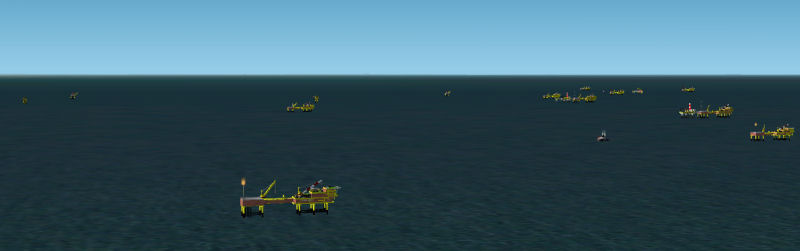
Leman Field
Web: www.fsdeveloper.com/forum/showthread.php?t=2509
