
Where Rivers Meet: Landscape, Ritual, Settlement and the Archaeology of River Gravels
University of Birmingham, 2006. (updated 2012) https://doi.org/10.5284/1000311. How to cite using this DOI
Data copyright © University of Birmingham unless otherwise stated
This work is licensed under the ADS Terms of Use and Access.


Primary contact
Simon
Buteux
Birmingham Archaeology
University of Birmingham
Edgbaston
Birmingham
B15 2TT
UK
Tel: 0121 4145513
Fax: 0121 4145516
Resource identifiers
- ADS Collection: 492
- ALSF Project Number: 3349
- DOI:https://doi.org/10.5284/1000311
- How to cite using this DOI

Downloads
Project Reports
The Where Rivers Meet reports are divided into six volumes; a summary of the contents of each volume can be found on the overview page.
Volume 6: Ground Truthing
For simplicity, the Digital Archive for Volume 6 has been separated into its four component chapters:
- Chapter 1: Ground Truthing
- Chapter 2: Geophysical Survey
- Chapter 3: Geoarchaeology
- Chapter 4: Magnetic properties
Chapter 1: Ground Truthing and Post-excavation assessment
The text element of Chapter 1 can be downloaded as a Portable Document Format. Additional figures and Plates can be downloaded as individual PDF files. Please note that these illustrations are not included in the main document.
| Volume 6 Chapter 1: Catholme Ground Truthing and Post-excavation assessment | 973 Kb | |
| Volume 6 Chapter 1: Title Page | 10 Kb |
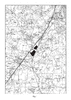 |
Figure 1: Site Location | 2600Kb | |
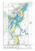 |
Figure 2: Focus Area | 7000Kb | |
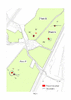 |
Figure 3: Location of excavation areas | 167Kb | |
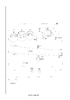 |
Figure 4: Area A1 | 25Kb | |
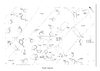 |
Figure 5: Plan of A2 | 43Kb | |
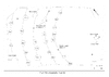 |
Figure 6: Schematic plan of A2 | 18Kb | |
 |
Figure 7: Plan of B1 | 15Kb | |
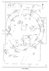 |
Figure 8: Plan of B2 | 50Kb | |
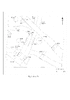 |
Figure 9: Plan of F1 | 21Kb | |
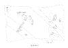 |
Figure 10: Plan of F2 | 24Kb | |
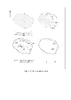 |
Figure 11: F100 - the central burial | 47Kb | |
 |
Figure 12: Section drawings | 26Kb | |
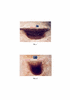 |
Plate 1 and Plate 2 | 1300Kb | |
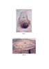 |
Plate 3 and Plate 4 | 1900Kb | |
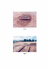 |
Plate 5 and Plate 6 | 1850Kb |
